


Fishing
Fishing in the Unsetåa
The Unsetåa has pools, rapids and quieter stretches, with opportunities to fish for both trout and grayling and a dedicated fly-fishing zone.
Discover fishing in the Unsetåa →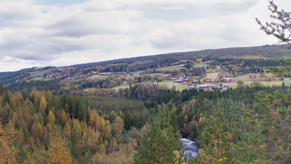
An old farming village along the Unsetåa river, with roots in the Iron Age and a cultural landscape where farms, outfield, hunting, fishing and mountains are still connected.
It is easy to drive through a small village without thinking about how much history the landscape contains. Unset is different. Here, the farms are closely connected to the surrounding landscape, the Unsetåa follows the valley floor, and beyond the farms begin the forests, outfield and mountains.
The landscape helps explain why people settled here.
Fertile soil provided the basis for farming. The river provided water. The forests and mountains provided grazing, firewood, game and other resources. Over the centuries came hunting, fishing, iron production, charcoal burning, tar production, summer farms, new farmsteads, a school, a cooperative store and, eventually, new forms of business and tourism.
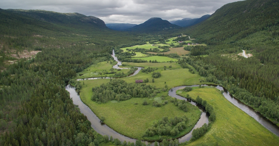
Unset lies in a narrow valley east of Fonnåsfjellet. Unsetdalen is around twelve kilometres long and approximately three kilometres wide. The valley floor lies at around 400 metres above sea level, with the Unsetåa winding through it.
Forested slopes rise on both sides of the valley. It is a landscape with clear natural boundaries – and the farms sit in the middle of it.
The fertile areas of the valley were important to early agricultural settlement. The farms of Unset are therefore not located here by accident. The landscape has been part of the settlement's history for centuries.
Unset is an old farming village with roots in the later Iron Age. The Norwegian Directorate for Cultural Heritage describes Unset as a village with some of the oldest and richest historic buildings in Rendalen, with long continuity in farming practices, building traditions and settlement patterns.
Archaeological finds from the farms include material from the Iron Age and Middle Ages, including a Viking Age silver hoard. The surrounding outfield also contains traces of earlier use, including hunting and trapping systems, iron production, charcoal pits, tar kilns and old riding and transport routes.
Today, Unset village and Unnsetbrenna form part of a landscape identified by the Norwegian Directorate for Cultural Heritage as a cultural landscape of national interest through the KULA register.
It is not one particular building that makes Unset special. It is the whole landscape.
Farmyards, fields, roads, the Unsetåa, forests and outfield belong to the same system. This is the landscape that the Norwegian Directorate for Cultural Heritage highlights as having a long cultural and agricultural continuity.
When you look at the farms today, you are therefore not simply looking at a modern agricultural landscape. You are seeing the result of centuries of people clearing land, building homes, moving livestock, harvesting the forest and using the mountains.
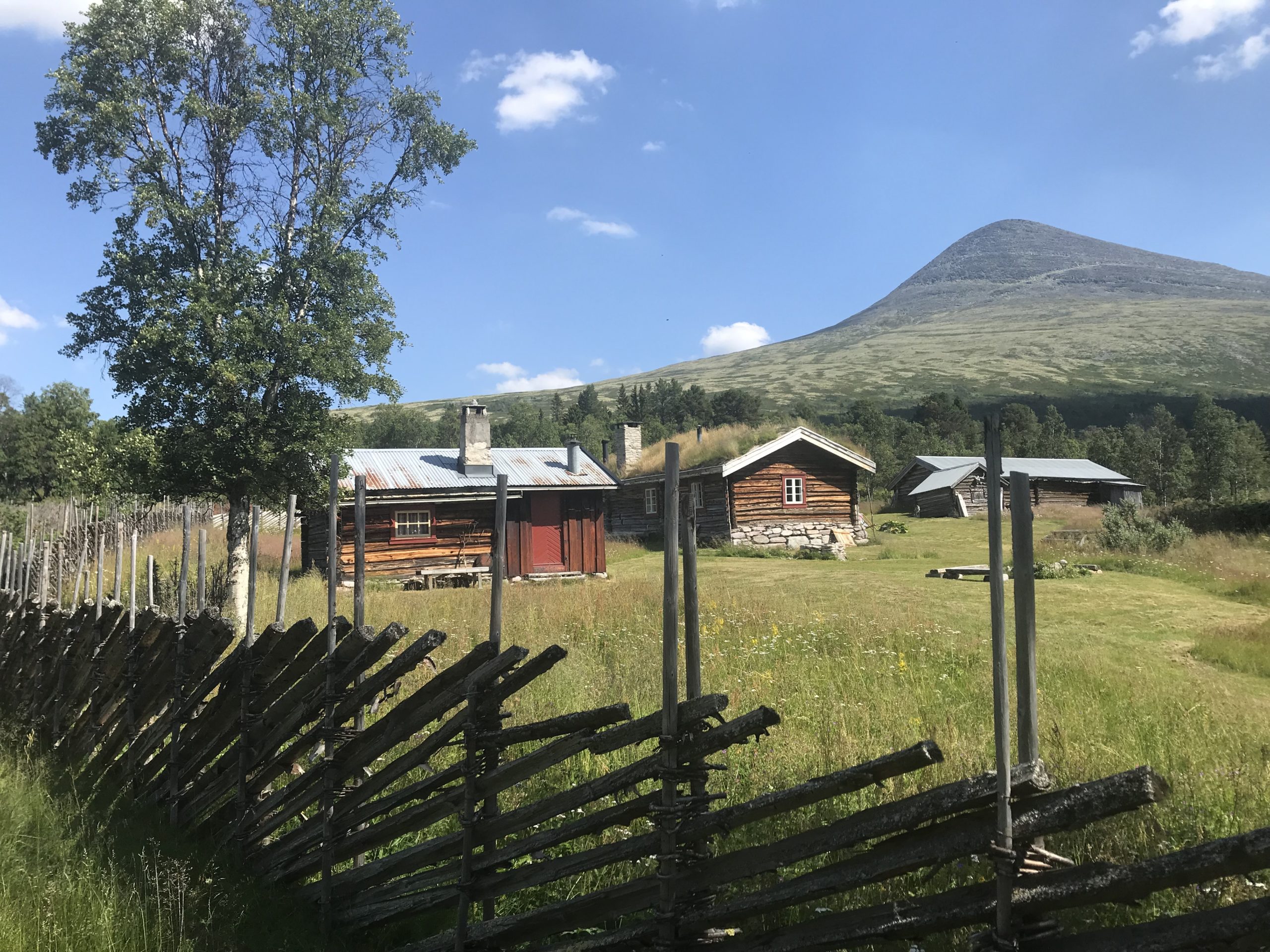
At Unset, the history is not only found in archives. It stands in the farmyards.
The barfrøstue is a distinctive building tradition from Eastern Norway. Several examples remain in Rendalen, and local historical sources connect several of them to Unset and Romenstad.
The buildings tell something that a date alone cannot: how people lived, how the farms functioned and how building traditions developed in a landscape where winter, forests and farming shaped everyday life.
Nobel Prize-winning author Sigrid Undset had family roots in Unset, and her surname is connected to the place. It is not the main story of Unset, but it is a fascinating reminder that small places can have connections reaching far beyond their own landscape.
For the people who lived at Unset, the farm was not simply the fields and buildings around the house. The outfield was part of their livelihood.
The forests and mountains provided resources for food, construction, fuel, grazing and income. The traces are still there: hunting and trapping systems, iron production sites, charcoal pits, tar kilns, summer farms and old routes through the landscape.
When you leave the farms and walk into the surrounding landscape, you are therefore not leaving Unset. You are entering another part of its history.
The Unsetåa runs through the heart of the landscape. The river is more than a geographical feature. It is one of the structures that connects the different parts of Unset.
The Unsetåa forms part of a protected watercourse, with important values connected to landscape, plants, birds, wildlife, aquatic life, cultural heritage and outdoor recreation.
Today, the river is also a very tangible experience. It holds both trout and grayling and has a dedicated fly-fishing zone.
Discover fishing in the Unsetåa →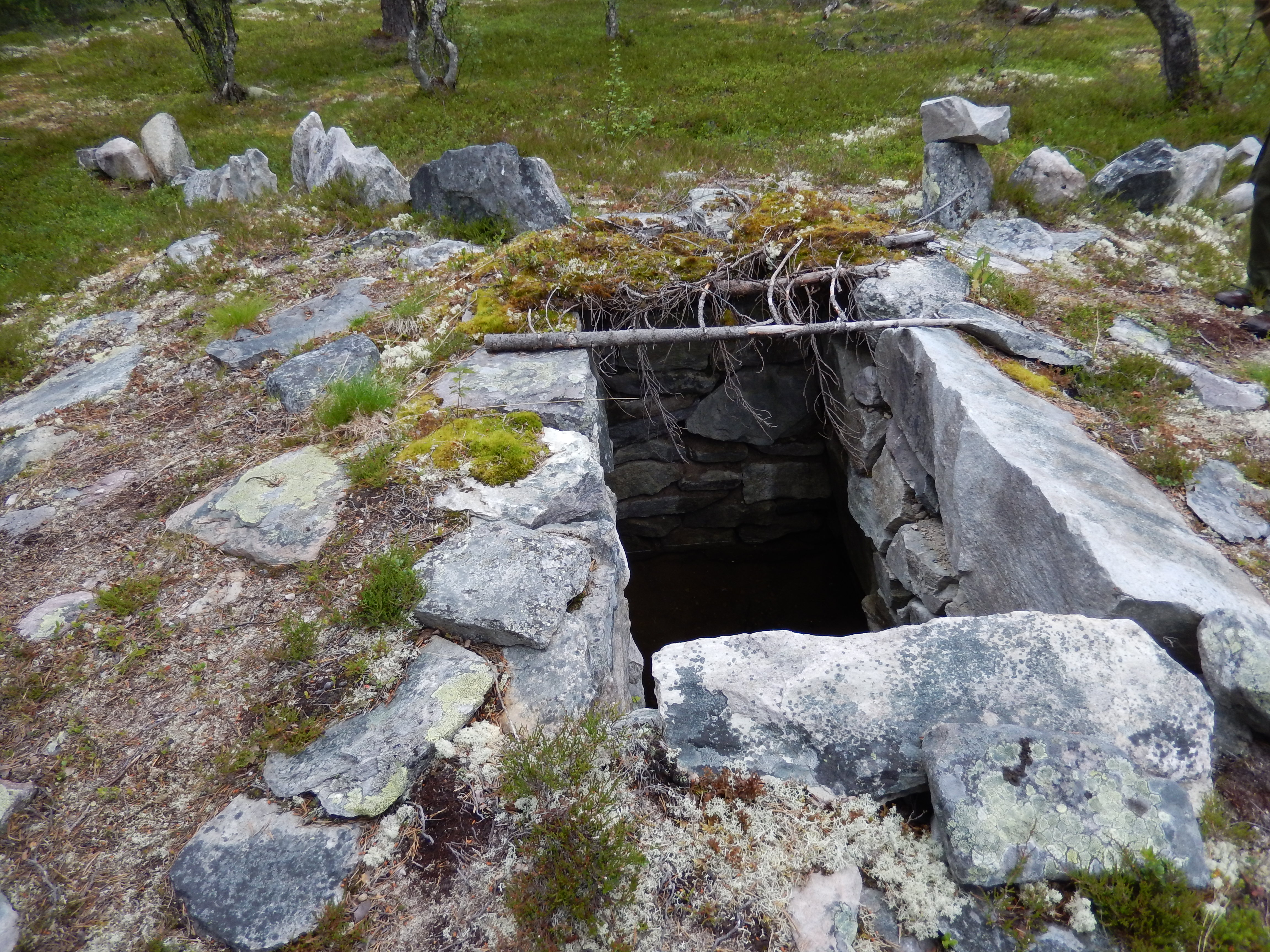
In 1917, Unset Kooperative Handelslag was established. During its first years, the cooperative operated from an old schoolhouse. A new store building was completed in 1925.
The store became an important part of everyday life in the village. It was about goods, but also about people, meetings and news from the outside world.
In 1968, the premises were converted to self-service. The store finally closed in 2009 after 92 years of operation.
The store disappeared. Unset remained.
The KULA landscape identified by the Norwegian Directorate for Cultural Heritage includes two very different farming communities in the same valley: Unset village to the south and Unnsetbrenna further north.
Unset has roots reaching back to the later Iron Age and represents an old farming culture with long continuity. Unnsetbrenna represents a much newer settlement history, connected to the Norwegian smallholding and land-settlement movement of the twentieth century.
Two histories. One landscape. Together they make Unsetdalen easier to understand.
It is easy to romanticise old villages. But Unset is not an open-air museum.
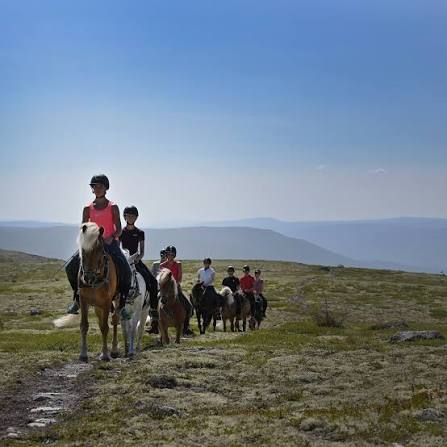
People live here. Farms are still used. The landscape is maintained. And new businesses have found ways of using the same resources that have always mattered: farms, horses, mountains, hunting, fishing and history.
Perhaps that is the most interesting part of Unset's story: the landscape is still being used – simply in new ways.
Discover Rendalen Fjellridning →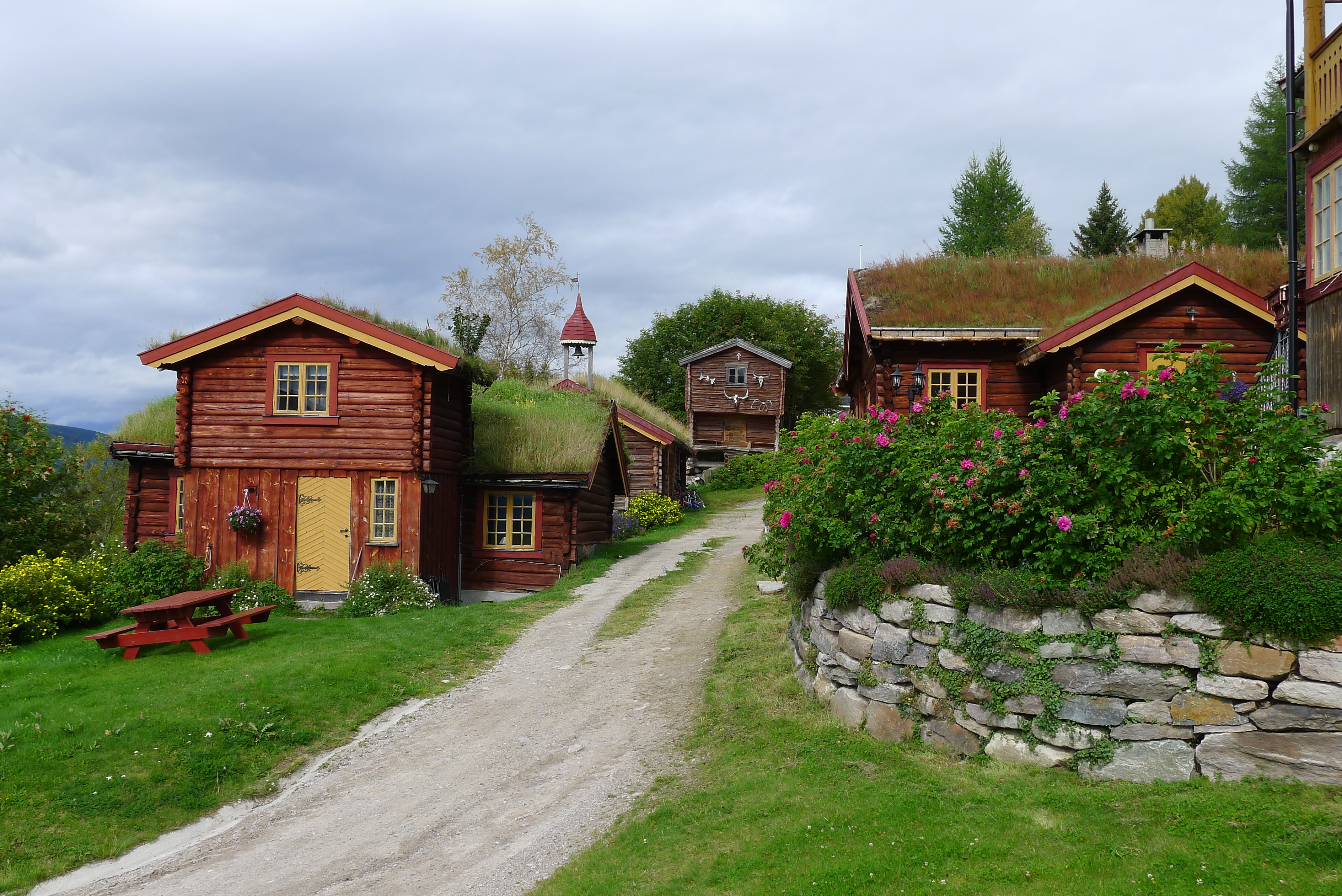
At Romenstad, the connection between farm, outfield and cultural heritage becomes tangible. Visitors can experience historic buildings, accommodation, hunting, fishing, canoeing and local history.
In the cultural heritage park, you can walk among historic hunting and trapping pits and experience a reconstructed trapping system. It offers an insight into how people once used the landscape to secure food and income.
Romenstad has also been awarded Olavsrosa, a Norwegian cultural heritage quality mark for experiences strongly rooted in Norwegian cultural heritage.
Experience the cultural heritage park →Beyond the farms, the landscape opens up. Fonnåsfjellet is close by, and further into the area lie extensive mountain and outfield landscapes.
Here you find summer farms, mountain lakes, historic routes and cultural heritage sites. Unset is therefore not only a destination in its own right. It is also a natural transition between the agricultural landscape and the mountains.
For anyone wanting to understand the connection between farming, outfield use, summer farming, hunting, fishing and mountain life, this may be the most interesting thing about Unset.
Explore Spekedalen and Sølensjøen →Experiences directly connected to Unset and the surrounding landscape.
The Unsetåa has pools, rapids and quieter stretches, with opportunities to fish for both trout and grayling and a dedicated fly-fishing zone.
Discover fishing in the Unsetåa →Horse riding from Unset into the eastern mountains – combining farms, summer farms, horses and mountain experiences.
Discover Rendalen Fjellridning →Walk among historic hunting and trapping pits and experience a reconstructed trapping system in the landscape around Romenstad.
Experience the cultural heritage park →Place: Unset
Municipality: Rendalen
Village: Yes
Statistical district: 04320207 Unset
Population: 115 people in the statistical district, April 2026
Valley: Unsetdalen
Valley length: approximately 12 km
Valley floor: approximately 400 metres above sea level
River: Unsetåa
Cultural landscape: Unset village and Unnsetbrenna are designated as a cultural landscape of national interest.
The population figure refers to Statistics Norway's statistical district Unset and should not be interpreted as an official geographical boundary for the village itself.
Unset is in Rendalen municipality in Innlandet, in Unsetdalen along the Unsetåa and east of Fonnåsfjellet.
Unset is particularly known for its old agricultural landscape, long settlement history, historic farmyards, cultural heritage, the Unsetåa and its proximity to extensive mountain and outfield areas.
The Norwegian Directorate for Cultural Heritage describes Unset as an old farming village with roots in the later Iron Age. Archaeological finds also include material from the Iron Age and Middle Ages, including a Viking Age silver hoard.
Statistics Norway recorded 115 people in the Unset statistical district in April 2026. The statistical district is a statistical geographical unit and does not necessarily correspond exactly to the local boundaries of the village.
Unnsetbrenna is the northern part of the cultural landscape known as Unset village and Unnsetbrenna. It represents a more recent settlement history connected to twentieth-century smallholdings and land settlement.
Yes. The Unsetåa offers opportunities to fish for both trout and grayling and has a dedicated fly-fishing zone. Always check current fishing permits and regulations before fishing.
You can fish in the Unsetåa, explore cultural heritage, visit Romenstad, go horse riding in the mountains with Rendalen Fjellridning and use the area as a starting point for experiences in the forests, mountains and outfield.
Yes. Local historical sources state that Sigrid Undset had family roots in Unset and that her surname is connected to the place.
It is the combination: an old farming village with roots in the Iron Age, a rich agricultural and cultural landscape, the Unsetåa running through the valley and extensive forest, outfield and mountain areas just beyond the farms.
Continue into Rendalen – to its villages, stories, experiences and landscapes.
All villages → All experiences →Norwegian Directorate for Cultural Heritage: Cultural landscapes of national interest
Innlandet County Municipality: 16 landscapes of national interest in Hedmark
Lokalhistoriewiki: Unset

©Opplev Rendalen 2026. All Rights Reserved